The map below indicates the 14 year plan for track production, it does not indicate the ‘lines’ or tram routes though it does indicate the intended direction for the routes on each rail segment.
In almost all instances there will be only one track on each right-of-way used. Running a single track per street on streets that are close in proximity and parallel to each other is both an efficient use of resources and a more equitable distribution of benefits.
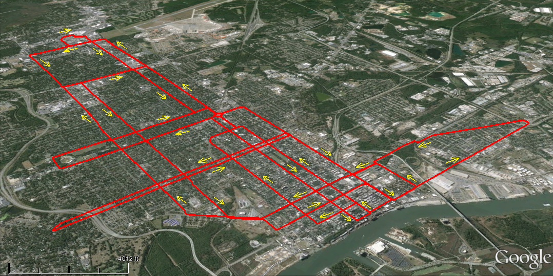
The first phase would be 13.81 miles of track (includes 1.2 mile of support track) running principally north-south from Bay Street to Oglethorpe Mall. Its historic district portion will run north on King and south on Whitaker.
The elimination of travel lanes will be relatively few, most notable are situations on Whitaker and Drayton. In most instances, public right-of-way that has long been abandoned for use as parking will be recouped for its original purpose. Other corridor options will include roadway medians, unused existing right-of-way, and, though rarely, the purchase of additional right-of-way.
The recovery of public right-of-way now used for private parking should be recognized as a proper step in a growing city which has greater needs for the publicly owned resource. Contiguous public space that forms a right-of-way is exceedingly valuable land that should not be relegated to serve as a parking lot.
Parking for automobiles can be accommodated with any parcel of land, and where needed the city can purchase parcels for public parking. In Savannah’s case, there are numerous opportunities for parking on side streets in residential areas outside of the city center that should provide adequate mitigation for wherever parking space losses occur.
Note, also, that only one track will be placed on a given street. In cases where parking exists on both sides of the street, the remaining parking side could well gain spaces if bus service was present and is then discontinued, as the bus stops could be converted to parking spaces.
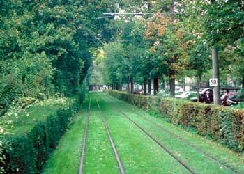
In a few locales medians will be utilized, when large enough. This can be achieved while still acting as a buffer for automobile traffic and providing green space for the thoroughfare. As seen below the rail bed can be constructed with the intent of maintaining a green lawn between and alongside the tracks.